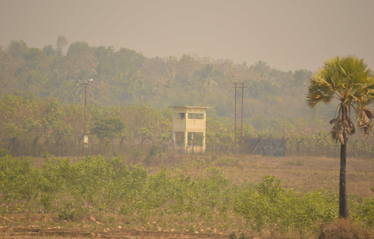
At a minute past midnight on August 1, 2015, about 11.1 square miles of India became par of Bangladesh while about 26.8 square miles of Bangladesh became part of India. Meanwhile an estimated 16,113 Bangladeshis earned a right to switch over to Indian citizenship and 39,554 Indians earned a right to switch over to Bangladeshi citizenship.
The exchange sounds like the result of a bloody battle, or some bitter treaty of attrition and aggression. But on the ground, the majority of citizens on both sides of the border celebrated the transition with parties and fireworks because rather than a bitter resolution, this land swap was a landmark effort by the two countries to resolve one of the world’s weirdest and most irksome border disputes ever.
India and Bangladesh have shared a roughly 2,500 mile land border for 68 years, dating back to the era when the latter nation was still a part of Pakistan, which formed out of the subcontinent’s rough post-colonial partition in 1978. For the most part, that border was sane and stable. But one section of the border was just a wreck, with multiple enclaves and exclaves of India inside of Bangladesh and of Bangladesh inside of India. Maps of the region were highly disputed, but by one count Bangladesh contained 102 Indian enclaves, 21 of which had chunks of Bangladesh within them—and one of these 21 pieces of Bangladesh within pieces of India within Bangladesh had another piece of India within it, known as Dahala Khagrabari, the world’s only counter-counter enclave and an uninhabited 1.7 acre patch of farmland worked (technically illegally) by a Bangladeshi man. (This wasn’t even the smallest enclave, though. That honor goes to Panisala, a 0.27 acre patch of India in Bangladesh.) India meanwhile contained 71 Bangladeshi enclaves, three of which had chunks of India within them. These enclaves were almost impossible to rig up with basic services like utilities, and citizens living on them found themselves all but stateless.
No one’s sure how this border formed. Local folklore says that the patchwork pattern was the result of a series of chess games between the Hindu Maharajah of Cooch Behar and the Muslim Nawab of Rangpur, minor Indian kingdoms which sublimated their warlust into table sports. According to this legend, in every game the lords would each write the name of a village on a chit and then the winner would claim the loser’s bet no matter where it lay. Then when Cooch Behar became part of India and Rangpur part of Bangladesh these chit mahals (or bet slip areas), as they were still known, had their silly borders hastily reified into fact during partition’s chaos.
More sober accounts hold that the odd divisions were just the result of a series of hectic peace treaties made in the early 18th century between the two kingdoms, one of which backed the imperial Mughals against the other. But this tradition still maintains that national leaders, more concerned with madness elsewhere, simply left this arrangement be in the independence era.
Hostilities with Pakistan from 1947 onwards prevented any real attempt to address this unfortunate situation, and likely exacerbated it. But after Bangladesh won its independence in a brutal war of separation in 1971, it looked to shore up its own frontier with India, proposing a land swap of 111 bits of India from their territory for 51 bits of Bangladesh in India in order to create a smooth and rational boundary. Then India and eventually Bangladesh promptly ignored and only occasionally reconsidered this arrangement for the next 41 years of border tension.
Then this spring, India brought the deal back up, finally passing it through parliament in May. No one’s entirely sure why the idea of a land swap resurfaced, but the going supposition is that New Delhi is trying, under the leadership of Prime Minister Narendra Modi, to make nice with all of its neighbors to counter the growing influence of the regional rival, China, in the sub-continent. That seems to have some credence given that the deal’s reemergence comes alongside a multi-billion dollar line of credit to Bangladesh and the development of new economic zones for cross-border trade and transit lines between major Bangladeshi cities and Indian border hubs.
The 2015 version of the deal sticks to the old 162-chit swap, additionally offering citizens the right to either migrate or switch nationalities accordingly, establishing safe lines of conduct and a nearly one-year transitional period, and setting aside some resources to help the transition come through. Bangladesh gladly agreed. The swap went off without a hitch. And now everyone’s waiting for the transition to reach its absolute completion by June 30, 2016.
This border swap, resolving nearly seven decades of chaos and showing a firm commitment to mending fences in the region, is cause for joy. It’s only the second time that India has managed to address a territorial dispute seriously. And the first was with Sri Lanka over an uninhabited island in the 1970s, so there’s not a whole lot to applaud there, especially compared to this major breakthrough involving big tracts of land and thousands of people. Unfortunately this landmark deal comes nowhere close to resolving India’s total border woes, and there’s no reason to think the nation’s thousands of miles of other disputed lands will be settled anytime soon.
The vast bulk of India’s border beef lies with China, the very force it was courting Bangladesh to score soft points against. Many more of their disputes lie with Pakistan, their existential arch-nemesis. (China is only a practical foe for influence, not a profound, philosophical quandary.)
The Chinese dispute stems from India’s use of British surveyors’ maps, established while China was weak in the 19th century to set borders to which the modern People’s Republic of China claims neither it nor its predecessor states truly consented. As a result, India lays claim to Aksai Chin on its northwestern frontier, 14,380 square miles of land currently held by China as part of their Xinjiang province, and to Arunachal Pradesh, 32,333 square miles of territory containing 1,382,611 people and currently run as an Indian state but claimed as a part of Tibet by Beijing. Other bits and pieces of the Indo-Chinese border (thousands of square miles) are under more piecemeal split control, and in the past this has escalated to violence. Recently that’s involved border skirmishes and chest puffing. But in 1962, the two nations fought a full-out war, during which India was all but defeated, and China voluntarily returned to its old line of actual control, awaiting negotiations to resolve the underlying border conflicts that never came to pass.
The Pakistani dispute meanwhile is, no big surprise, a legacy of the absurdities of the partition era. Most people know that both India and Pakistan claim, control parts of, and always seem on the brink of war over the Kashmiri region. But they also dispute some marshes on the southern border between the two nations, and glacial and mountainous features in the Karakorum Range. Much more blood has been spilled over this more contained conflict than was with China, and at any point there’s always a sense of dread that conflict could reemerge—a fear absent with China.
India stands a real chance of resolving some minor border disputes it has with the Maldives (over the Indian island of Minicoy) and with Nepal (over a few small tracts of land under de facto Indian control). And it has an incentive to talk to these nations as part of its efforts to buddy up in the region and score points relative to China.
But despite some pretenses towards negotiating with China over border issues this year, the willpower just doesn’t seem to be there. Or at least it doesn’t outclass wariness. That’s even truer in the case of Pakistan. So while India’s been able to right one exceptionally messy border wrong this year, and could fix a couple more longstanding issues in the immediate future, there’s no real reason to hope that the country’s most volatile, massive and miserable border disputes will end soon. We can only hope they don’t explode.